|
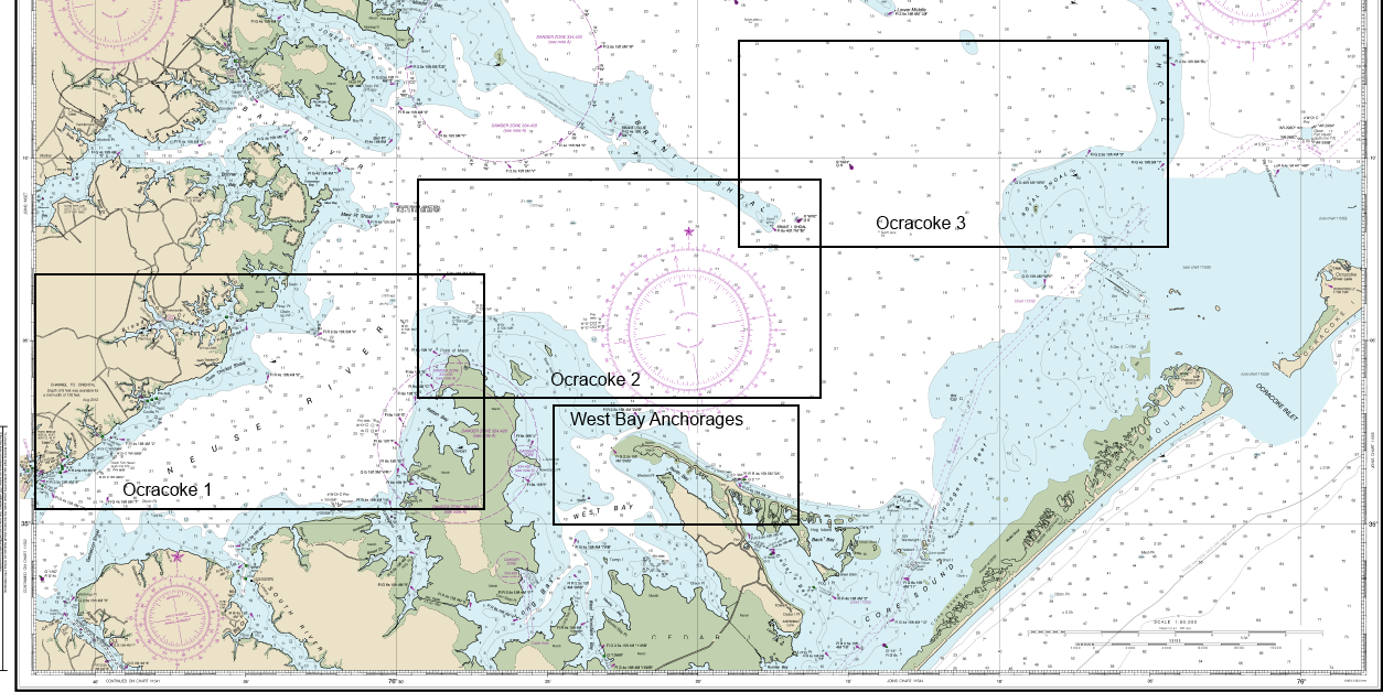
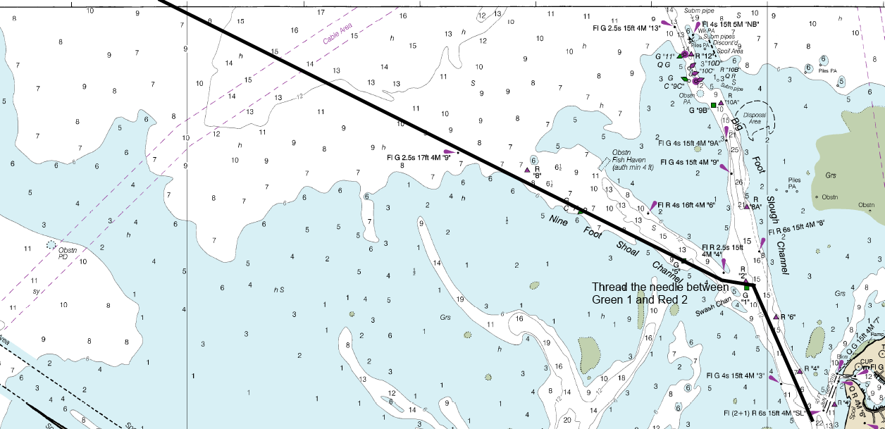
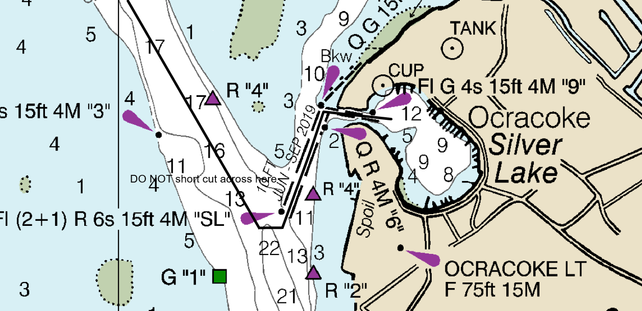
Member Howard Cheetham has put together some excellent aids for using 9 Foot Channel as an alternative to Big Foot Slough. This route has been used by many members as a slightly shorter and more direct channel to the Ocracoke Silver Lake basin.
The links below provide information with a route, waypoints and details drawn on NOAA Charts 11548 and 11550. Howard suggests taking a look at all of them, but if you like to plot your own course; the pdf file has the waypoints, the kmz file opens in Google Earth to give an overview and the gpx file should be compatible with all modern Chart Plotters (if you know how to load a route).
chart 11548 detail selections.png chart 11550 detail selections.png
Ocracoke route 1.png
Ocracoke route 2.png
Ocracoke route 3.png
Ocracoke route 4.png
Ocracoke route 5.png
Oriental to Ocracoke via 9Ft Shoal.pdf
Oriental to Ocracoke via 9Ft Shoal.gpx
Oriental to Ocracoke.kmz
West Bay Anchorages.png
The latest Army Corps of Engineers surveys of the channels and Silver Lake can be found at https://www.saw.usace.army.mil/Missions/Navigation/Hydrographic-Surveys/Side-Channels-Small-Harbors/.
The 2021 survey for Silver Lake, for anchoring and avoiding a sandbar generated by the ferry's wash is here:
Silver_Lake_Harbor_1.pdf
In case anyone wants to do battle with ferries and the shoaled "kink" in Big Foot slough, the 2021 survey is here:
Bigfoot_Slough.pdf
The positions of the temporary markers between 8/9 and 11/12 are correct in the latest NOAA chart which can be downloaded from: https://charts.noaa.gov/PDFs/11550.pdf
If you've updated your Chartplotter maps since July 21 2021 they should also be correct - otherwise keep your eyes open - this is why we now recommend 9Ft Shoal; the marks haven't changed to my knowledge in the past 10 or more years. Howard Cheetham - Vice Commodore Cruising, 2021
|

